California is a land of many treasures and ever since the Gold Rush of 1849 visitors have delighted themselves in making discoveries of all kinds in the beautiful and majestic Sierra Nevada Mountains. For those of us who love winter recreation and lots of snow, the mighty Sierras hold endless treasures to discover – much more than the more touristy, high-profile locations in glitzy Southern California.
Two of those jewels are in Mono County, not far from Yosemite National Park. Both are open to snowmobilers – the region around the resort town of Mammoth Lakes and the Bridgeport Winter Recreation Area, northwest of the town of Bridgeport.
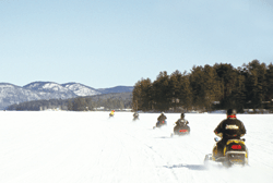
We rode in both locations and found broad meadows decorated with patches of coniferous trees, rocky outcropping and slopes of various angles, all covered with a solid base of snow that allowed snowmobilers access to the vast and beautiful backcountry without fear of repeatedly sinking or digging out all day.
Exploring Bridgeport
After flying into Reno, Nevada, we headed south into the Golden State and made our way along historic U.S. Highway 395 to the Virginia Creek Settlement, just south of Bridgeport and about 70 miles south of Lake Tahoe. Upon arrival the owners, Jimmy Little and his wife, Brinn, who operate the roadhouse restaurant and the nearby cabins, nestled in a valley between the highway and bubbling Virginia Creek, warmly welcomed us. After a tasty dinner there, Jimmy explained the local history and described the Bridgeport Winter Recreation Area, where we would be riding the next day.
Little, a seasonal winter employee of the U.S. Forest Service, would prove to be a well-prepared and knowledgeable host. After breakfast, we stopped at the Bridgeport Ranger Station and piled into a big 4×4 pickup before heading upcountry on State Route 108, passing the U.S. Marine Corps Winter Warfare Training Center at Pickel Meadows along the way. During the winter, Highway 108 over Sonora Pass is closed to automotive traffic at the foot of the mountains, with a one-lane bypass around the barrier for those headed to the Winter Recreation Area. Waiting for us there was another Forest Service employee, Brian Dodd, and our three snowmobiles to propel us through this adventure.
We loaded and trailered those sleds up the highway into the Humboldt-Toiyabe National Forest, where the road became steep, twisty and hairy in a hurry as the elevation changed. Patches of snow on the unplowed road became deeper and more numerous as we climbed higher.
At a convenient turnaround, we unloaded the sleds and used them to continue our ascent along the highway as the snow became noticeably deeper. On the way we encountered husband and wife Steve and Stephanie Chavez, who arrived just moments after Brian had nosed his sled into a hole while venturing off-trail. After taking a few minutes to free it, we continued our journey and it wasn’t long before we met an oncoming snow tractor. Its driver was a U.S. Marine sergeant from the Winter Warfare Training Center who said that his men were on a skiing exercise at higher elevations. Although we didn’t see them that day, Little said it’s not uncommon to encounter occasional troops while snowmobiling in the area.

The northern boundary of the Bridgeport Winter Recreation Area is alongside Route 108, so we had a view of its scenic splendor as we climbed toward the summit on the groomed highway. When we reached Sonora Pass and the Tuolumne County line, the wind was blowing and snow swirled around us. No wonder – at 9,623 feet, this is the second highest pass in California that is crossed by a highway, and is surrounded by even higher peaks.
After snapping photos, we turned around and ventured off-road, heading into the Bridgeport Winter Recreation Area. This 7,254-acre spread in the shadow of high Sierra peaks is a scenic wonderland that hosts visitors year-round, but it was created primarily for snowmobilers. Just beyond its far edge opposite Route 108 is the renowned Pacific Crest Trail – a premier hiking trail that stretches from the Mexican to Canadian borders that was featured in the 2014 movie “Wild.”
Pointing to the skyline of a ridge, Little said, “Up there is the only place that snowmobiles are allowed to cross the Pacific Crest Trail. There are signs posted, but riders need to have a good map so that they stay clear of other sections of that trail, as well as the wilderness areas that are outside the boundaries of the recreation area.”
With the Pacific Crest Trail buried under more than 5 feet of snow and the next hikers not likely to appear before June, it seemed unnecessary to have such a crossing restriction in place; but as they say – rules are rules.
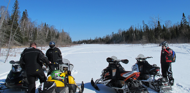
Once clear of those areas, and keeping our leader in sight, we explored at our leisure, romping through large open areas, climbing some hills and winding our way through pines. The powder was inviting and the up-and-down riding was a treat, interrupted only by the occasional need to dig a stuck machine out of the fluff.
We frolicked in the deep snow for a while before traveling to Leavitt Lake, where a huge mountain slope loomed over the hidden, snow-covered lake. After more riding we formed up and made the first part of our descent through the Leavitt Creek valley, then connected back to Route 108 for the downhill ride to our trailer. As we paused to admire the view before loading the machines, Little told us more about riding in the region.
“The Bridgeport Winter Recreation Area was established.by Congress in 2009 as the first motorized winter recreation area in the nation,” Little said. “Because it’s so new, not everyone is aware of it, so we’re doing all we can to promote it as a destination for great off-trail riding.
“Visitors are required to sign in and obtain a permit at either the Ranger Station in Bridgeport or at the gate on Route 108, but there’s no charge for that,” Little said. “The permit system allows us to track usage of the area and see where the visitors are coming from.”
Depending on the amount of snow cover, there are also other places to snowmobile in the area.
“The riding opportunities vary greatly from season-to-season and even week-to-week throughout the winter,” Little explained. “When the lower elevations have good snow, you can ride around Bridgeport and head east toward the Sweetwater Mountains – The most popular destination is Bodie State Historic Park and its ghost town about 15 miles east of Bridgeport, which you can reach over an unplowed road.”
On To Mammoth

After bidding farewell to our first hosts, we headed south to the resort town of Mammoth Lakes, where the 11,059-foot Mammoth Mountain boasts the highest ski area in California. Even more impressive is the amount of precipitation this area receives each winter – about 400 inches per season, making it one of the snowiest places in the state. Between those storms, the area averages 300 sunny days per year, so it’s obvious why this is a prime locale for winter recreation and a great place for a crossover vacation.
I was the only guy not lugging a snowboard or skis when I checked in at the Mammoth Mountain Inn, but it didn’t take long to feel right at home in the wonderfully cozy room with snow piled high right outside the window. The next morning, it was a short walk to Mammoth Snowmobile Adventures, the resort’s rental operation, where we joined one of the 90-minute, guided snowmobile tours. Behind our guide, Yeeshkah Condon, we cruised a web of groomed trails, stopped to gaze into one of the Inyo Craters – a gaping volcanic explosion pit – and ended up at windswept Minaret Vista lookout, where the view toward the distant Minaret Peaks was stupendous. The trailing-arm wearing 2-up rental sleds may not appeal to those looking for an extreme mountain riding adventure, but they were easy to operate for a short tour like this that appeals to less experienced riders who want to see the grandeur of the backcountry.
When that touristy ride was over, we hooked up with two Mono County sheriff deputies on snowmobiles, John Pelichowski and Jeff Beard, who showed me around more of the area. Besides climbing back to the Minaret Vista, we ventured around the backside of Mammoth Mountain where a branch of the San Joaquin River meandered through an idyllic, snowshrouded valley and past a deserted campground. This was Red’s Meadow, bordering on the Ansel Adams Wilderness and very near Devils Postpile National Monument, which is off-limits to motorized travelers. It was a beautiful spot, but what struck me most were several signs alongside the unplowed road advising skiers not to panic, but to simply proceed to a nearby telephone if they needed to be rescued.
“Adventurous skiers sometimes come down the forested side of Mammoth Mountain and end up here,” Pelichowski explained. “It happens fairly often, so the signs are meant to reassure them and the phone is available if they need to be rescued.” The idea of a landline in the remote backcountry seems odd, but it gets used more than occasionally in this location, he said.

The Mono County Sheriff’s Department also gets many cell phone calls for help, so they’re prepared to go wherever needed – although it often takes a fair amount of time to get there, given the county’s large size. Typically, the officers operate in teams – five for search and rescue and two for law enforcement. “You wouldn’t believe some of the things people do before they end up calling for help,” Pelichowski said.
We capped off the day at Mammoth Mountain with a visit to nearby June Lake, where we stayed overnight at the Double Eagle Lodge. This property features a full-service restaurant as well as a number of spacious and well-appointed cabins perfect for relaxation after a day on the snow. Not far from town is June Lake Junction at the intersection of U.S. Highway 395 and State Route 158, where the snowmobile trail is part of the network that traverses a portion of the nearby Inyo National Forest and provides access to the town of Mammoth Lakes.
For snowmobilers in California, Mono County offers a warm welcome, plenty of snow and a variety of experiences. If you’re looking to ride in the Golden State, put it at the top of your list.
Editor’s Note: Every issue of Snow Goer magazine includes in-depth sled reports and comparisons, aftermarket gear and accessories reviews, riding destination articles, do-it-yourself repair information, snowmobile technology and more! Subscribe to Snow Goer now to receive issues delivered to your door 6 times per year for a low cost.

