We were learning why this loop is called Superior Challenge-West, as we were put to the test in some form for each of the five days we were on the trail. This was just one challenge in a long list, and we were only on the second day.
We kept our eyes open for the gorge, which identified itself by the large Trans-Canada 17 bridge and railroad bridge spanning the river. After that, we were told to proceed with caution.
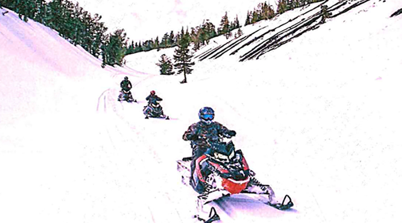
It didn’t surprise us that something steep and dangerous would exist on this trail. For the past day and a half, we’d traversed some incredibly challenging and unpredictable terrain. Our shoulder muscles were sore from cranking our sleds around blind, hairpin, rock-studded turns; the payoff was some of the most spectacular views overlooking Lake Superior.
Sometimes, however, legend precedes reality. We didn’t really know we’d hit the big drop until it was over — and we all had to come to an agreement that this hill had been the one.
We could understand why extraordinary measures are sometimes needed to get the groomer up the incline. For riders, however, it wasn’t as scary as were the warnings. It was steep and a bit icy, and one wouldn’t want to have sleds parked at its base, as it’s a sharp left to stay on trail. As for death and destruction, the amount of brush and trees on the drop-off side of the trail would likely keep someone from going over the brink.
It wasn’t until we reached the river bottom, crossed over and turned around to see what we’d just ridden that we were silenced. Never in my years of snowmobiling have I been in such awe of nature. The rest of the group was equally stunned by the dramatic cliff that juts skyward, almost larger than can fit in a camera frame.
That’s the magic and the mystery of riding on this little-explored side of Lake Superior. Everything is bigger, everything is more rugged and everything is more spectacular than anything on any other area of the lake. People talk about lake effect snow; we were experiencing the effects of the lake.
Lake Superior has many faces. There’s the beautiful North Shore of Minnesota, with its rocks and bluffs. There’s Wisconsin, with sandy beaches and islands. There’s Michigan, with the lighthouses, layered cliffs and thick forests. Then, there’s Ontario, which is Minnesota, Wisconsin and Michigan combined and multiplied exponentially.
Whatever the other borderlands of Lake Superior has, Ontario’s offering is bigger, bolder and more dramatic.
That’s why we took a ride on the wild side. While we’ll still gladly ride near the lake in other states, we were really blown away by the grandiose beauty (and uncrowded trails) in Ontario.
Towns along the route are not cutsie — there are no fudge shops, kitsch dealers or charming places that make you romanticize about moving north.
These are practical towns for practical people, like Bob, the trapper who appeared on snowshoes in a clearing near Nipigon. He had been checking his traplines for martens (and there was evidence of his catch on the sledge pulled behind his utility snowmobile). He pointed to the high ridgeline and told of his plans to get up there to check even more traps, then said that there have been times when he’s had to hike 15 miles out of the woods when his snowmobile has broken down. It’s just a part of life in this area.
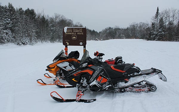
Not only is it remote for the people who live here, it’s remote for snowmobiling. In nearly 600 miles of trail, there were few road crossings — mostly just crisscrossing the Trans-Canadian. Nipigon had only 10 trail permits to distribute and we took five of them. Representatives at the Chamber of Commerce suggested calling ahead for the permits (a hefty $100 for a seven-day permit) and they would gladly deliver them to a local hotel. Come with cash, though. They’re not set up for credit cards.
We were there in the beginning of February — early season, according to most people. Prime time is late February through early March. January, according to most, is just too dang cold and the snow is less predictable.
We had excellent snow the entire route, though with all the rocks, we could see how it can get scraped away in a hurry. We also experienced a wide spectrum of temperatures, from above freezing to rain to temperatures well below zero.
We’ve learned that the best plans are no plans, so we only arrived in Nipigon with two ideas: we’d start and end there. We had a five-day window.
We would have liked to start just north of the Minnesota border in Thunder Bay, but land-access issues had closed the trail from there to Nipigon. So we trailered another 45 minutes north.
Tourism people in this area have been working hard to attract snowmobilers, and have designated two “Challenge” loops. It seems that the east loop has been more popular. While those riders may be on a more well-beaten, well-established trail, they’re really missing the “challenge” part of the trip that the west loop provides. The trail weaves along the lake, and loops up into the north, making a circle back to Nipigon.
Our first day was sunny, so we opted to follow the lakeshore. It’s what we really wanted to see and, as weather can be unpredictable, we wanted to use the best days by the lake.
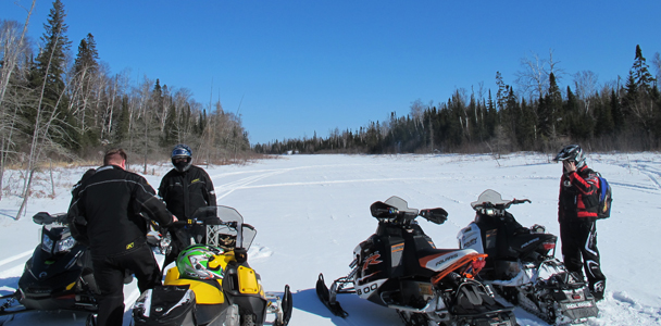
A good two hours into the trip, we saw our first real on-trail sighting of the lake. And, as we always do when the lake comes into view, we stopped and took pictures.
We got our first up-close-and-personal visit with the lake after our lunch stop in Gravel River.
There’s nothing impressive about the name Gravel River. There’s not even very much there except a lakeside outpost/restaurant/motel/gift shop/ice fishing stop. But head south on the river, just under the Highway 17 bridge, and out to its mouth and it’s one of the few places one can snowmobile atop the greatest of the great lakes. There’s a packed trail where Gravel River Resort owner Ray Laukkanen hauls his ice fishing patrons to the hotspots. Lake trout, herring, whitefish — it’s all there, swimming beneath the ice.
Locals we talked to say they avoid twisty, rough sections of trail between Nipigon and Gravel River by cutting across on the frozen lake. The next thing they talk about are the pressure ridges that have nearly killed them. That’s one good reason we stayed off the lake and remained on the trails.
This is, however, the one place we dared to go on the ice. We slipped under the bridge and entered the large bay. Truthfully, it wasn’t the biggest thrill we had on the trip, but it’s the place we earned bragging rights for riding on top of the world’s largest body of fresh water. We pinned our throttles, did some donuts and took pictures of each other under the waning afternoon sun.
We ended the day in Terrace Bay. It was just more than 100 miles, but the sharp twists in the trail, the constant elevation changes and negotiating rocks and other obstacles left us worn out.
We found lodging, ate dinner and headed to the local watering hole for some drinks and games of pool. The big-screen television in the bar played snowmobile videos and murals on the walls depicted life in this town: curling, fishing and, of course, snowmobiling.
We talked to several people there who had a hand in building the trails and who spoke of the challenging terrain. A lot of these trails follow power lines, which seems like the path of least resistance. That’s not necessarily so. Riding these trails gives one a new respect for not only the trail-makers, but for anyone trying to build anything in this undulating land.
After breakfast the next day at a small bakery surrounded by an impressive collection of Gordy Howe memorabilia, we continued on to Marathon. This is where the east and west loops meet, and it’s also where the trail leaves the lake. We really stretched out this limited time along the lake. Once we turned inland, we knew the terrain would change and the power of Superior would dissipate. It did, but it also set us up for more adventure in Ontario’s true back country.
In the spirit of international goodwill and understanding, three Americans and two Swedes demonstrated old-fashioned democracy somewhere outside of Manitouwadge.
We were lost — or, better stated, misplaced — somewhere along Trail A. At least we thought it was Trail A — it was signed as such, but there was also at least one “closed” sign.
We couldn’t find our location on the trail map and the compass wasn’t much help, but we knew this: We were perched on top of a rocky slope, a clear-cut powerline swath stretched as far as we could see both ahead of us and behind. What was a decently traveled stretch of trail when we left town 15 or so miles back was now reduced to just two or three tracks, all of which went straight down into a powdery abyss.
We could see the tracks weave into the trees and emerge farther down the strip. Should we press on, or turn around? It was time for a vote, roll-call style.
Marcia went first: “Turn around.”
Me: “Turn around.”
Jonas: “Press on.”
Johan: “Turn around.”
Joe: “My vote doesn’t matter, since there’s already a majority.”
We knew he wanted to press on, as he’d been lobbying for it since we hit our kill switches. However, majority did rule, and we turned around. The “Turn Arounders” felt quite vindicated with their choice as each sled, as it was turned, got stuck in the deep, wet, cement-like snow. Even the “Press On-ers” had to see that democracy prevailed for a reason.
Before people call us idiots for riding on a trail posted “closed,” they need to ride in this area. We’d seen “closed” signs planted on previous days’ trails that were obviously open. A local snowmobiler had also pointed us down this trail. It was an honest mistake. Honest. After consultation with an old trail map, we determined that we were on last season’s trail A. The new routing was on the other side of town.
As much as we’d enjoyed our night in Manitouwadge — after dinner at the pizzeria/flower shop/hockey shrine and several rounds of five-pin bowling at the bar/bowling alley/laundromat — it was time to press on. As with each day, we were never quite sure of our final destination and figured as long as we had fuel, we could find lodging. Of course, in areas this remote, we bought gas every time we passed a station.
This area is built around the mining industry, which has hit some tough times. Many buildings we saw were empty or for sale. People we talked to generally mentioned the poor local economy. We also drove through some fairly desolate areas to get to Longlac, the town on the north edge of Long Lake. There’s a trail that cuts up Long Lake, starting by Lake Superior. It was closed when we were there, due to groomer problems. That wasn’t bad for us: 50 miles of lake-running sounded cold and boring.
Longlac has several lodging options, and was the largest town on this side of the trail. There were also a large number of French speakers here, adding to the town’s flair.
It was also here we decided on our next destination: the Pasha Lake Cabins, north of Jellicoe.
This is one place where we could have spent quite a bit of time, had our “real lives” not been calling us back home. Resort owners Darrell and Susie Splett have done a nice job creating a welcoming place on a beautiful northwoods lake. There’s also access to more than 230 miles of trail, much of which is semi-private. We got a forest road map from Darrell, and went out on our private trails — some groomed, some bushwhacked by us. Much of these trails will be included on the next Ontario Federation of Snowmobile Clubs system, but it’s remote enough that we can’t envision much traffic. The abundant snow was due to lake effect flakes off of Lake Nipigon.
We also had one of the best meals of the trip in Pasha Lake’s new communal lodge. We bought supplies for spaghetti in the local Jellicoe market, and made our own deluxe meal. The Spletts have opted not to prepare meals themselves, as they don’t want to compete with local dining establishments. This lovely setting did come with a price, however, and was the most expensive stop on our trip at about $45 U.S. per person per night.
The areas north of the lake are decidedly more smooth than along the lake. There are still some considerable elevation changes, but they are not sharp ups and downs. The powerline trails are more what one would expect, and there’s more a wide-and-sweeping feel than tight-and-twisty.
It started to become more rugged as we got closer to our starting point in Nipigon. When we got to the point outside of Nipigon, where the trail split for us four days ago, there was some melancholy that the trip was nearly finished and the rest of the driving would be done in a truck.
From the dramatic cliffs, to the twisty trails, remote lodges and more hockey memorabilia than one could have possibly thought existed, We found our challenge and met it, skis-first, snowmobiling Superior’s North Shore of Lake Superior.